In recent years, climate change has contributed to various weather extremes, including heavy precipitation and cold waves. As a result, a new study has identified a potentially growing natural hazard in the north: frostquakes. These seismic events are caused by the rapid freezing of water in the ground and could become more common due to the effects of climate change. Surprisingly, researchers found that wetlands and drainage channels play a significant role in the origin of frostquakes, specifically in regions with irrigated wetlands.
Frostquakes are seismic events that occur during extreme winter conditions when wet, snow-free ground freezes rapidly. These events have been reported in various locations, such as northern Finland in 2016, 2019, and 2022, as well as Chicago in 2019 and Ottawa in 2022. Previously, it was believed that roads were the primary areas where frostquakes originated. However, the new study reveals the unexpected importance of wetlands and drainage channels in the occurrence of frostquakes.
When water accumulates in the ground, either from heavy rainfalls in autumn or the melting of snow during warm winter weather, the rapid freezing and expansion of the water cause cracks in the ground, accompanied by tremors and booms. Frostquakes can be felt by people in populated areas, often accompanied by specific noises. In fact, the ground motions during frostquakes are comparable to those of other seismic events, such as distant earthquakes, mining explosions, and vibrations from freight trains. Permafrost regions are also known to experience frostquakes.
The recent study conducted by researchers from the University of Oulu and the Geological Survey of Finland (GTK) is the first to investigate seismic events originating from marsh and wetland areas. They discovered that fracturing in the uppermost frozen ground can occur if the thickness of the frozen layer is approximately 5 cm or larger. These ruptures can propagate deeper, potentially damaging essential infrastructure such as buildings, basements, pipelines, and roads.
With climate change resulting in rapid changes in weather patterns, frostquakes have gained attention and may become more common. While their intensity is usually low, a series of relatively strong frostquakes that damaged roads in Oulu in 2016 prompted the research. However, frostquakes remain relatively understudied using seismic instrumentation.
The study found that wetlands and areas with high water tables or places where water accumulates are the main sources of frostquakes in the winter of 2022–2023 in Oulu, Finland. Furthermore, irrigated wetlands and drainage channels near roads were observed to be areas where fractures propagated during frostquakes. These factors highlight the need for further study and modeling of the role of wetlands and drainage channels in frostquake occurrences.
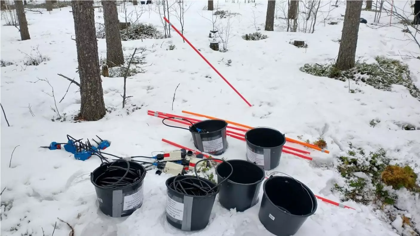
To gather data on frostquakes, the research team installed two seismic station networks in northern Finland, specifically in Oulu and Sodankylä. These stations recorded seismic signals and soil temperature data during the winter of 2022–2023. The researchers relied on reports from local residents regarding ground tremors and unusual sounds to identify frostquakes from the seismic data. Conditions favorable for a frostquake occur when the temperature drops below -20°C at a rate of about one degree per hour.
The study highlighted the presence of many wetlands close to the seismic stations in Oulu, where the main sources of frostquakes were detected. In Sodankylä, frostquakes were also caused by the fracturing of ice in the Kitinen river. These observations emphasize the need for more precise mapping of frostquakes in other regions to understand their prevalence. The researchers aim to create a system that can predict frostquakes based on soil analysis and satellite data. Additionally, the role of ditches in frostquake occurrences should be modeled using a technique currently under development at GTK.
As frostquakes have the potential to impact infrastructure and pose a risk to residential areas, further studies are crucial in identifying areas at risk. This knowledge will facilitate better preparation and protection of the built environment from this specific natural hazard. The researchers from the University of Oulu and GTK are determined to expand their studies and create a comprehensive system for predicting frostquakes. By combining soil analysis, satellite data, and monitoring techniques, potential areas at risk can be identified and appropriate measures can be taken.
Frostquakes, as a potentially growing natural hazard in the north, have gained attention due to climate change’s impact on weather patterns. Wetlands, drainage channels, and areas with high water tables play a significant role in frostquake occurrences, highlighting the importance of further research and modeling. Monitoring seismic signals and soil temperature can aid in identifying frostquakes and predicting their future patterns. With increased knowledge and preparedness, the built environment can be protected from the potential impacts of frostquakes.
Leave a Reply