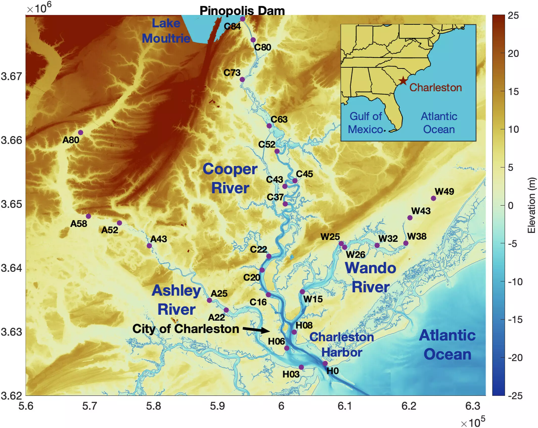
Flood management has long relied on the construction of dams as a means to control riverine floods. However, recent research has raised serious questions about the effectiveness of these structures—particularly in coastal settings. A study published in the Journal of Geophysical Research: Oceans sheds light on how dams, instead of mitigating flood risks, can inadvertently contribute to more severe coastal flooding. This article analyzes that research, focusing on the nuanced relationship between human-made barriers and the natural dynamics of waterways.
As climate change amplifies the frequency and intensity of storms, saltwater intrusion becomes a growing concern, and sea levels rise, the global trend towards building coastal dams appears justified. However, the implications of such infrastructure projects could be less straightforward than initially believed. Historical data from Charleston Harbor, South Carolina, reveals that the effectiveness of dams is contingent upon numerous factors, such as the physical geography of the estuary in question and the nature of storm surges themselves.
The Mechanics of Estuary Dynamics
The research, led by Steven Dykstra, makes a compelling argument about the shape and structure of estuaries. Traditionally viewed as environments where storm surges diminish in intensity as they move inland, the study suggests that the funnel-like design of estuaries can actually amplify flood waters when a dam is introduced. Dykstra likens the phenomenon to how waves behave in a bathtub, where certain frequencies can result in water splashing over the edges. Consequently, the introduction of a dam can reflect storm surge waves back inland, effectively heightening flood potential.
Case Study and Broader Implications
Focusing on Charleston Harbor, researchers analyzed over a century’s worth of data to understand fluctuations in coastal flooding. Their findings were corroborated by computer modeling applied to 23 different estuaries, both dammed and free-flowing, across varied geographic locales, including Cook Inlet in Alaska. This comprehensive approach underlined a critical insight: the geometry of the estuary and the additional constraints introduced by dams are pivotal in determining how storm surges behave. The study highlights that at certain magnitudes and durations, conditions can lead to an increase in the flood risk in dammed environments.
Another concerning revelation from the study is that the effects of dams and coastal alterations can influence flood risks far beyond the immediate vicinity of these structures. Importantly, the research indicates that high storm surges can reach areas over 50 miles inland. This realization underscores the misconception that inland areas remain safe from coastal influences. As sea levels continue to rise, more people located further from the coast may find themselves increasingly vulnerable to flooding, often without warning or prior indication.
The implications of the study demand a reevaluation of current flood management strategies, especially as climate change continues to reshape coastal environments. Reliance on dams as the primary means of flood prevention may need to be reconsidered in favor of a more integrated approach that accounts for the multifaceted dynamics of water movement in coastal settings. It is crucial for policymakers and planners to understand that the interactions between human infrastructure and natural systems are complex. As the study illustrates, what might appear to be a straightforward solution could, in fact, exacerbate the very problem it aims to solve.
In light of these findings, it becomes essential to fuse scientific research with proactive policy measures and community awareness, ensuring that everyone, including those living well inland, comprehends the risks associated with flooding in a changing climate. As we move forward, an informed and adaptable approach will be key to navigating the challenges of coastal flooding in the era of climate change.


Leave a Reply