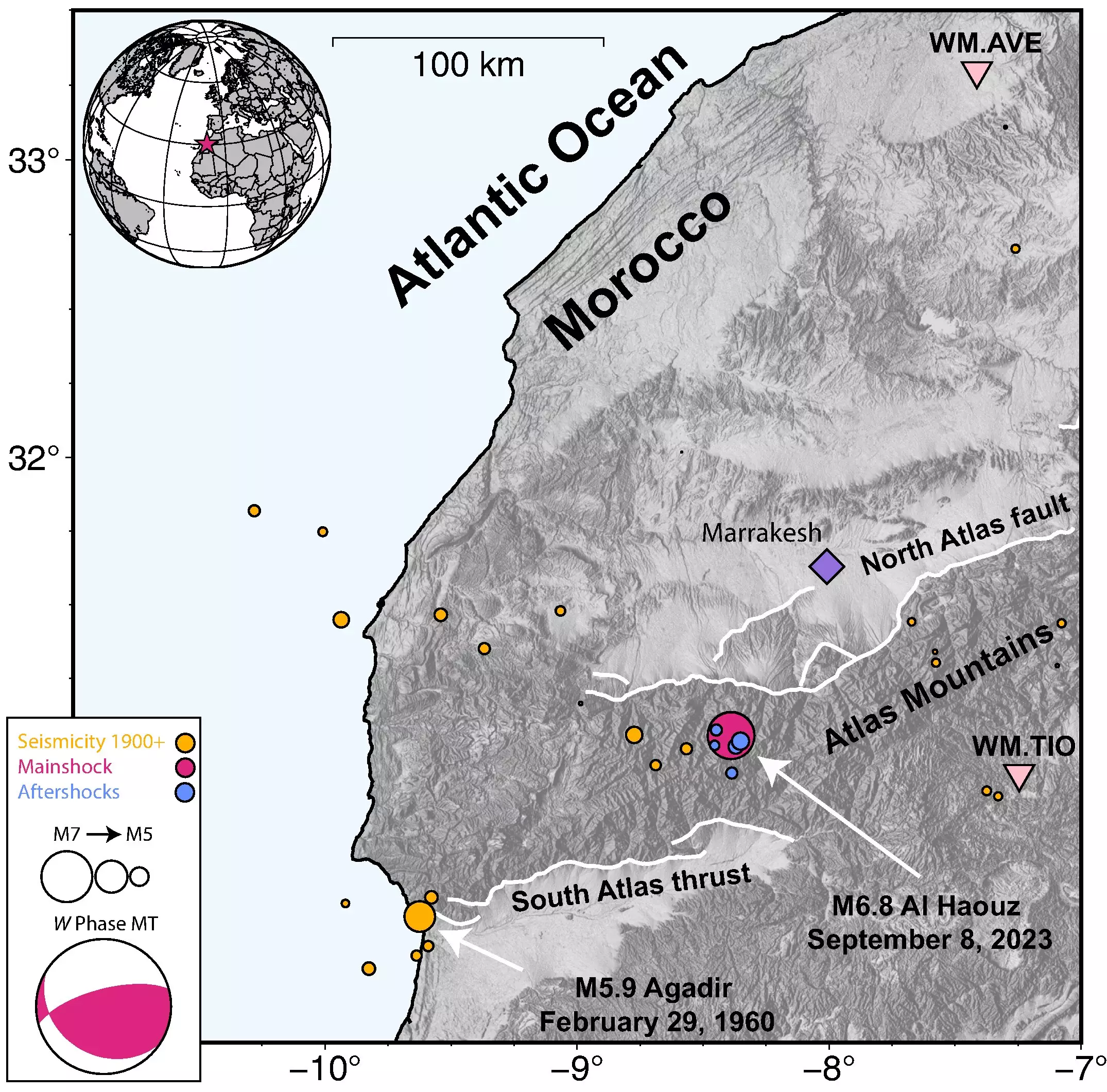
The magnitude 6.8 Al Haouz earthquake in Morocco, which occurred on September 8, remains a topic of interest and concern for scientists. Researchers from the U.S. Geological Survey’s National Earthquake Information Center (NEIC) have conducted a thorough analysis of the earthquake, shedding light on its magnitude, depth, and potential impact. This article aims to provide a comprehensive overview of the earthquake and the findings from the NEIC’s study.
One of the key findings from the NEIC’s analysis is the earthquake’s unusual depth of rupture. Typically, earthquakes in this region are expected to occur at shallower depths, but the Al Haouz earthquake ruptured approximately 25 kilometers beneath the surface. This unexpected depth raises questions about the seismic activity in the Atlas Mountains, where historically recorded earthquakes are scarce. According to U.S. Geological Survey seismologist William Yeck, the lack of data on large earthquakes in the region makes it challenging to determine the common characteristics of seismic events in the area.
Determining the specific faults involved in the Al Haouz earthquake presents another challenge for scientists. The earthquake did not break the surface, and only a few aftershocks were recorded. These factors make it difficult to confirm which faults were responsible for the earthquake. Yeck highlights the importance of understanding faulting in the region, as it provides valuable insights into the seismic hazard of a particular area. However, with limited data on aftershocks, it becomes harder to accurately image the faults and their behavior.
The seismic activity of the Al Haouz earthquake resulted in significant consequences for Morocco. The Moroccan province, after which the earthquake is named, experienced violent shaking near its epicenter and very strong shaking in Marrakesh. Reports indicated that nearly 3,000 deaths and 5,500 injuries occurred in the weeks following the earthquake. The widespread damage to structures further emphasizes the severity of the event. Such devastating consequences highlight the importance of understanding the characteristics and behavior of earthquakes in the region.
To gain a deeper understanding of the Al Haouz earthquake, the U.S. Geological Survey researchers utilized various data collection tools and techniques. Teleseismic data, which consists of seismic wave data collected from stations worldwide, played a crucial role in the analysis. Although the nearest seismic station was 100 kilometers away from the earthquake epicenter, the researchers combined this data with InSAR satellite data. InSAR technology captures changes in ground deformation and provides precise surface location information. By integrating these datasets, the researchers could develop comprehensive earthquake source models.
Through their extensive analysis, the U.S. Geological Survey’s National Earthquake Information Center has generated valuable insights into the Al Haouz earthquake. The earthquake’s atypical depth of rupture, challenges in fault identification, and significant impact on Morocco underscore the need for further research and understanding of seismic activity in the region. By combining different data collection techniques, scientists can piece together a more complete picture of earthquakes and enhance their ability to assess seismic hazards. The findings from studies like this contribute to ongoing efforts to mitigate the impacts of earthquakes and improve preparedness for future seismic events in vulnerable areas.


Leave a Reply