Farmland is often a battleground in the fight against climate change. Solar panels and energy crops are pitted against food production, while well-intended policy choices can create incentives for farmers to till up new lands, releasing even more heat-trapping gas into the atmosphere. That’s why strategies for sustainable plant-based fuels focus on marginal lands – fields that are too hard to cultivate or don’t produce good enough yields to be considered profitable.
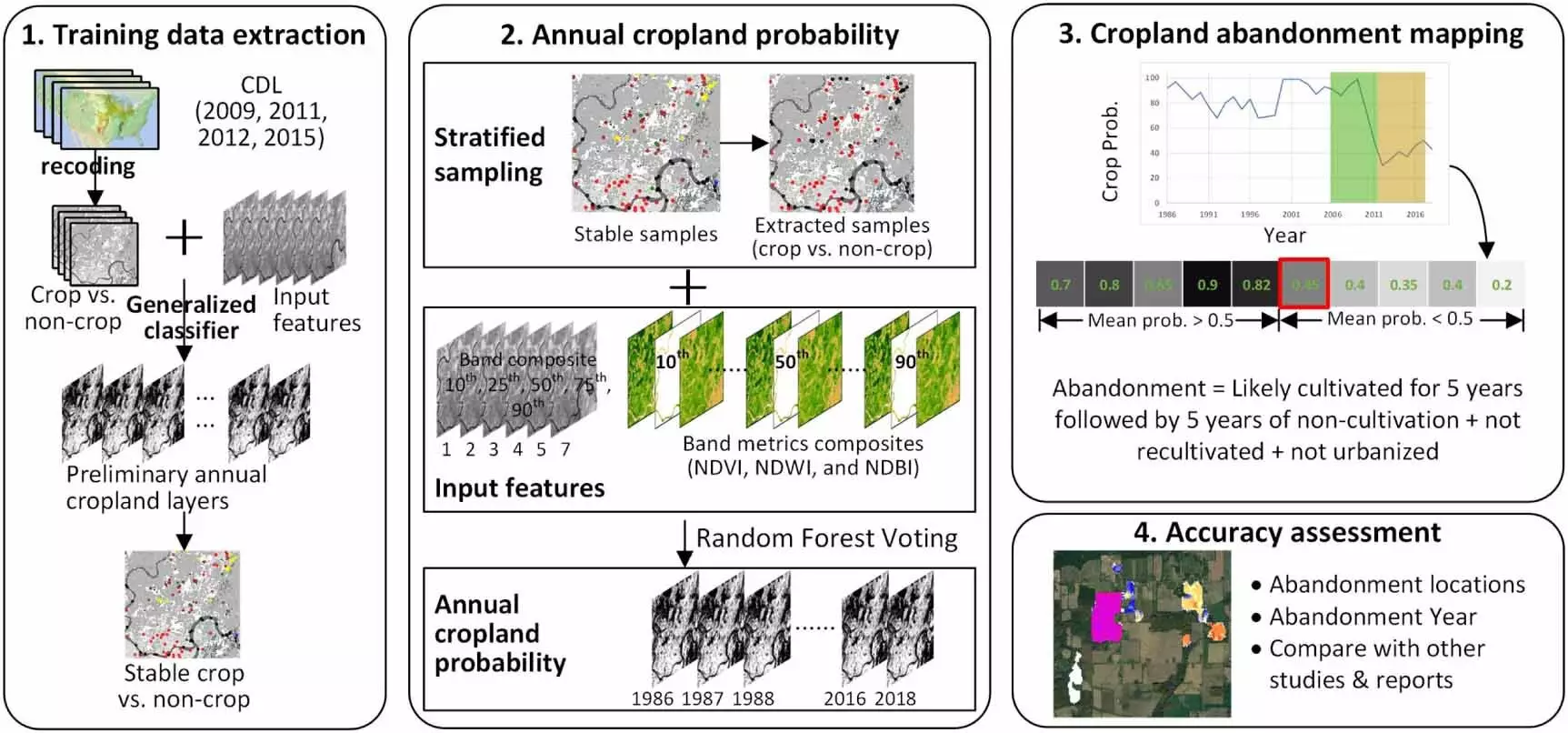
A new tool developed by scientists at the University of Wisconsin-Madison could help relieve the tension between energy production and food production. Led by Yanhua Xie and Tyler Lark, researchers with the Great Lakes Bioenergy Research Center, the team used machine learning to map nearly 30 million acres of United States cropland abandoned since the 1980s, creating a tool that could guide decisions about how to balance production of energy and food. Their findings, published in the journal Environmental Research Letters, include the most detailed mapping of previously cultivated land in the U.S. to date.
The resulting data are publicly available in the GLBRC’s interactive atlas of U.S. cropland, which also maps trends in farmland expansion and irrigation. While researchers have traditionally relied on datasets like the USDA’s Census of Agriculture, this tool provides a higher resolution analysis, looking right on the landscape – field by field, acre by acre – of where these croplands are. This high-resolution data can be used to model how much biomass could be grown on these lands and their potential to trap carbon dioxide from the atmosphere in the soil.
Understanding these abandoned lands could be key to directing clean energy investments where they have the least competition with other beneficial uses. The study found that more than 30 million acres of cropland were abandoned over a 32-year period, with most abandoned land concentrated in the Great Plains and along the Mississippi River between southern Illinois and the Gulf of Mexico.
Further Research and Analysis
While the study accurately predicts the precise location of abandoned croplands nine times out of 10 and can pinpoint the year they were abandoned with about 65% accuracy, more research is needed to determine why the lands were abandoned. The next step for researchers is to figure out the drivers behind the abandonment of these lands. By pulling in other information like socioeconomic data and tax records, researchers can identify potential uses for the land, such as growing bioenergy crops.
Technology, specifically machine learning and satellite imagery, has provided researchers with a powerful tool to identify abandoned croplands in the United States. By understanding the characteristics of these lands, researchers can determine their true potential for sustainable plant-based fuel production to help mitigate climate change. This data-driven approach could pave the way for new clean energy investments and applications like solar photovoltaic, agrivoltaics, and cellulosic bioenergy development on marginal lands that were previously overlooked.


Leave a Reply