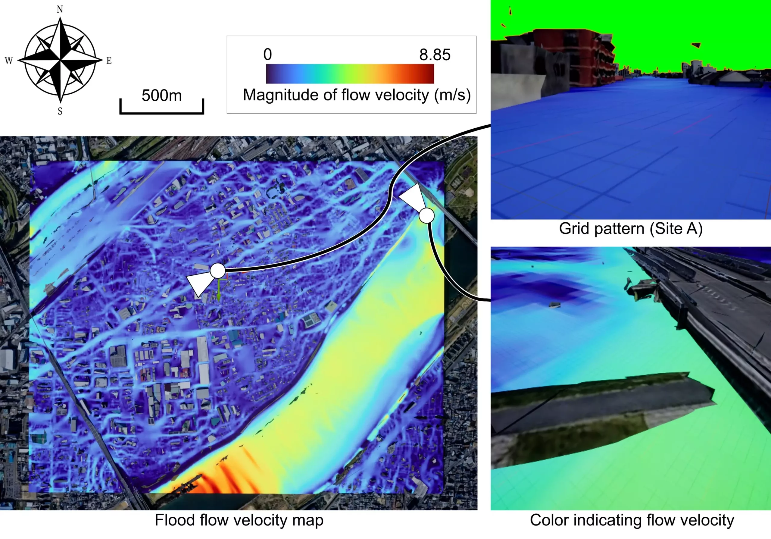
Climate change has led to an increase in flood risks in urban areas around the world. Heavy rainfall disasters have become a global issue, posing significant challenges to communities. Traditional numerical simulations are used to predict flooding from heavy rain and river overflows, but they often fall short in providing detailed risk assessments. This limitation makes it hard for residents to grasp the full extent of flood risks they face.
Researchers at Osaka University have introduced a game-changing solution to this problem – a mobile mixed reality (MR) system. This innovative system leverages server-based rendering and web-based access to provide real-time flood risk visualization. By utilizing this technology, urban populations can now access dynamic flood forecasts on their mobile devices, empowering them to better prepare for and respond to potential disasters.
The use of MR displays offloads the computational workload to a server, enabling efficient rendering and real-time visualization on smartphones and other commonly-used mobile devices. This approach not only simplifies access to flood forecasting tools but also eliminates the need for specialized applications. With the system accessible through web browsers, multiple devices can connect simultaneously, fostering widespread participation in MR visualizations.
One of the key features of this MR system is its intelligent assignment of rendering servers. By selecting the most suitable server from a pool of options, the system ensures efficient performance and scalability. This democratized approach to flood risk visualization makes advanced tools more accessible to a larger audience, enabling users to engage with MR visualizations without the constraints of dedicated software.
Lead author of the study, Ryoma Tsujimoto, emphasizes the critical importance of mitigating flood risks as climate change continues to pose a threat. The development of this mobile MR system represents a significant step forward in enhancing community preparedness and response to flooding events. By democratizing access to advanced flood forecasting tools, the system empowers users to take proactive measures in safeguarding their communities.
The integration of mobile mixed reality technology into flood risk visualization has the potential to revolutionize how communities plan for and respond to disasters. By providing real-time access to dynamic flood forecasts on mobile devices, this innovative system equips urban populations with the tools they need to mitigate risks and protect their communities in the face of climate change.


Leave a Reply