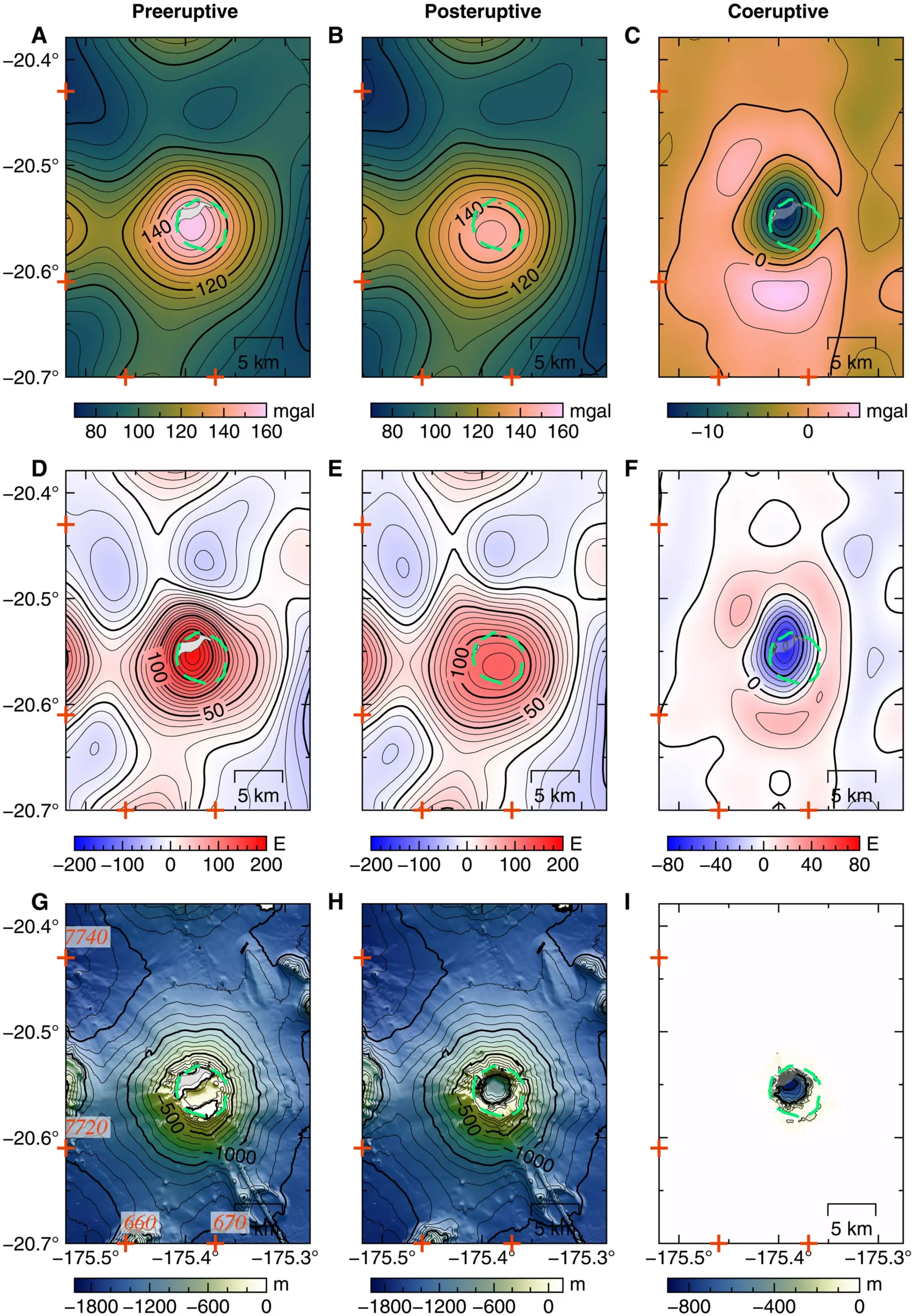
The Hunga volcano, located in the South Pacific, experienced a massive eruption in January 2022, causing its caldera to collapse and generating a tsunami that reached shores as far as the U.S. and Japan. However, due to its underwater location, studying this volcano and its eruption has posed significant challenges. To overcome these challenges, a team of geologists, volcanologists, and Earth scientists from various institutions undertook a new approach using satellite data to partially map the magmatic system state beneath the Hunga volcano.
Conventional sonar equipment cannot be easily deployed in underwater environments, making it difficult to gain insights into the magma chambers beneath the Hunga volcano. Instead, the research team utilized data from satellites equipped with highly sensitive technology capable of measuring subtle differences in sea levels worldwide. By analyzing the data from satellite radar pulses and multibeam bathymetry, the researchers could create partial maps of the magma chambers beneath the volcano.
The satellite data allowed the research team to observe the magma reservoirs before and after the eruption, enabling a detailed comparison. Their analysis revealed the existence of three distinct pockets of magma beneath the Hunga volcano. Two of these pockets were primarily composed of liquid magma, while the third consisted of mostly solidifying mush. This differentiation provides valuable insights into the dynamics of the magmatic system.
One crucial finding of the study was that the majority of the magma involved in the eruption originated from a central chamber. Approximately 30% of the chamber’s contents were expelled during the eruption, leading to the collapse of the caldera. The research team’s analysis further identified a connecting channel between the two liquid-filled chambers. This channel facilitated the replenishment of the magma lost from the central chamber, contributing to the continuous activity of the volcano.
The utilization of satellite data has provided valuable insights into the magmatic system beneath the Hunga volcano. By analyzing slight differences in sea levels above the volcano, caused by the presence of magma, the researchers were able to estimate the amount and size of the magma chambers. The team’s findings serve as a foundation for future investigations, as they suggest that further analysis of satellite data can uncover more intricate details about the magma reservoirs and their dynamics.
The study conducted by a team of scientists from multiple institutions has shed light on the magmatic system state beneath the Hunga volcano. Through the use of innovative satellite technology and data analysis techniques, they were able to map the magma chambers and distinguish between liquid and solidifying regions. Understanding the dynamics of these chambers is crucial for comprehending the eruptive behavior of the volcano. With the continued study of satellite data, more insights into the complex nature of the magma reservoirs beneath the Hunga volcano are anticipated.


Leave a Reply